
Police hunting for missing four-year-old boy Gus Lamont have turned to an extraordinary toolset – drones, artificial intelligence and ultra-high-resolution aerial imaging – to analyse the outback around his home at a scale human searchers could never achieve.
Gus vanished from his home at Oak Park Station in South Australia on 27 September 2025.
What followed was a vast ground operation: 163 SA Police officers and another 230 people, including Indigenous trackers, community volunteers, the State Emergency Service and the Australian Defence Force, combed the remote property and surrounding terrain.
Later, the search shifted from boots on the ground to algorithms in the sky.
On 5 February, SA Police Major Crime Detective Superintendent Darren Fielke revealed investigators had deployed technology from three Australian companies to analyse the landscape from above.
The results convinced police the boy had not “merely wandered off”, and the disappearance has now been formally declared a major crime investigation.
Capturing a wide radius
In a 30-minute press conference, Detective Superintendent Fielke demonstrated how investigators used “aerial AI imagery” to confidently assess Lamont was not in a 5.47 km radius: a common search distance for missing children aged between four and six years-old.
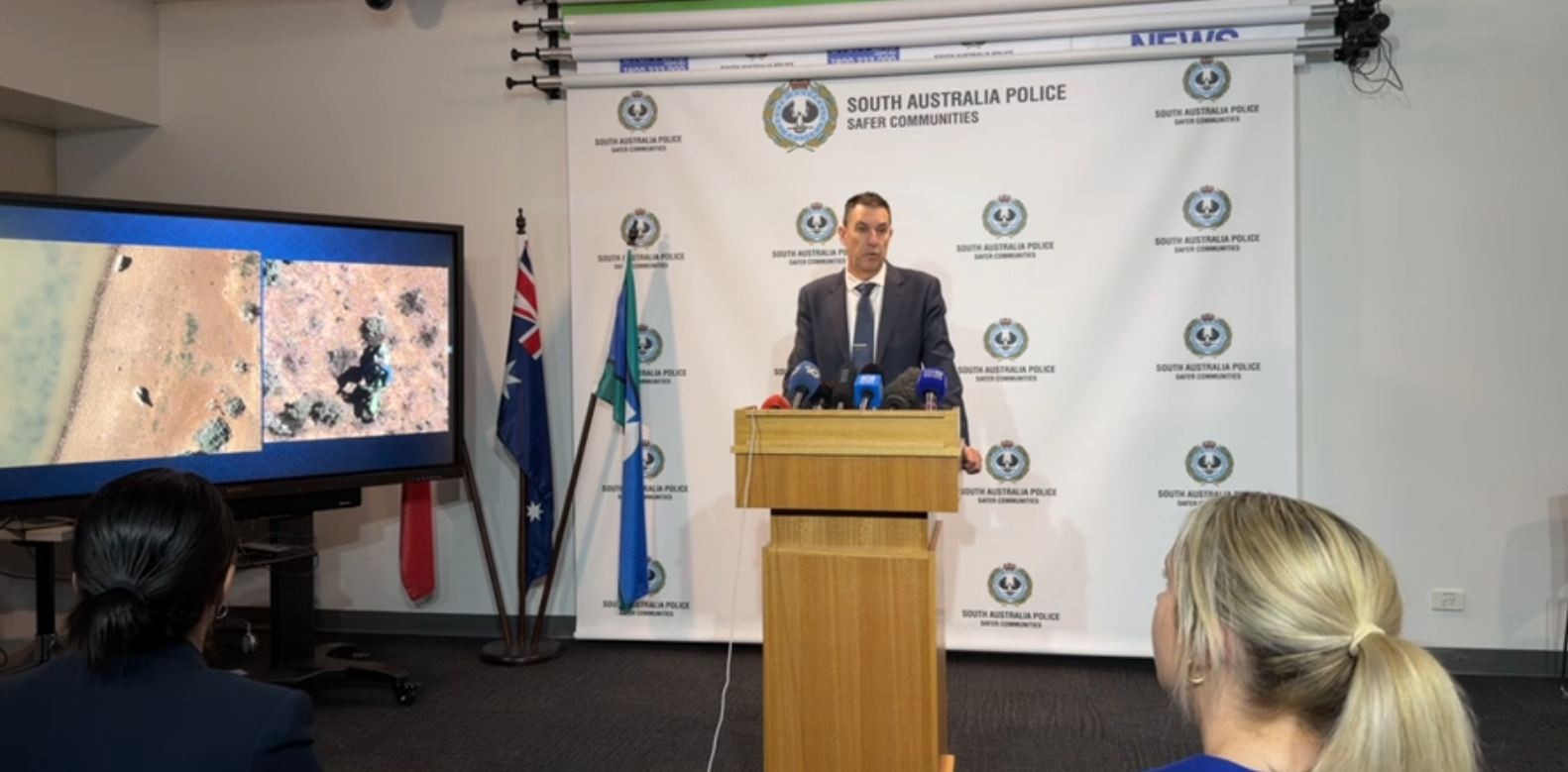
SA Police Major Crime Detective Superintendent Darren Fielke updates the media on the tech used to find Gus Lamont. Photo: Supplied
Investigators first flew helicopters using infrared sensors across a 12-kilometre area on the night Gus disappeared.
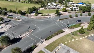
They then brought in specialist drone operators to conduct targeted sweeps within 2.5 kilometres of the homestead, including dams and nearby roads.
Remote-sensing firm Working Drones Australia captured an area using overlapping technologies – high-resolution imagery, thermal and other similar scans – and later incorporated AI to analyse the enormous data haul.
“As remote sensing scales up to tens or hundreds of kilometres, the processing requirement is too much for a human,” said chief executive Daniel Wood.
“So, we start to use AI models to assist.”
The aircraft search expanded again: police commissioned an aircraft equipped with highly specialised cameras, first covering a 10-kilometre radius, then 15 kilometres around the property.
In a recent example unrelated to Lamont’s case, Wood demonstrated the use of AI to detect non-human bones at a roadside location.
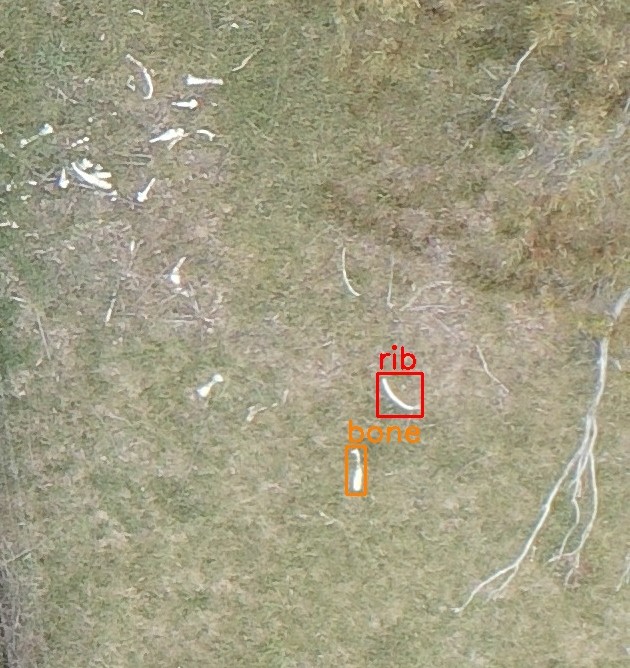
WDA can use AI to detect bones and other elements in aerial photographs. Source: Supplied
One human in a sea of animals
Property-intelligence company Nearmap captured “vertical imagery” at 1.5 cm ground sampling distance (GSD) using the company’s newest camera system tech.
The images were then analysed using AI software developed by Australian drone and analytics specialist Sci-eye.
“Imagery clarity is key,” Nearmap ANZ senior director of survey and geospatial content operations, M’Shenda Turner told Information Age.
“The clearer the imagery, the higher AI confidence score you can gain.”
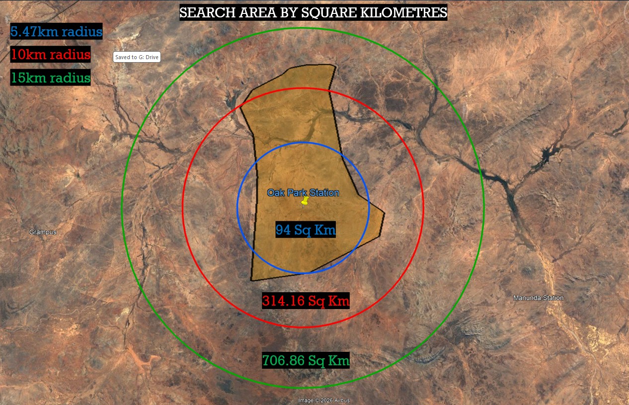
Police conducted an aerial search as far as 15 kms. Source: South Australia Police
The system scanned the vast station landscape and flagged 13 areas for police to investigate.
The scale of the task explains why automation mattered: the AI sifted through imagery containing roughly 10,000 sheep, 6,350 goats and 6,250 kangaroos – accurately separating species by colour.
It also located a single human: a motorcyclist riding within the 15-kilometre radius.
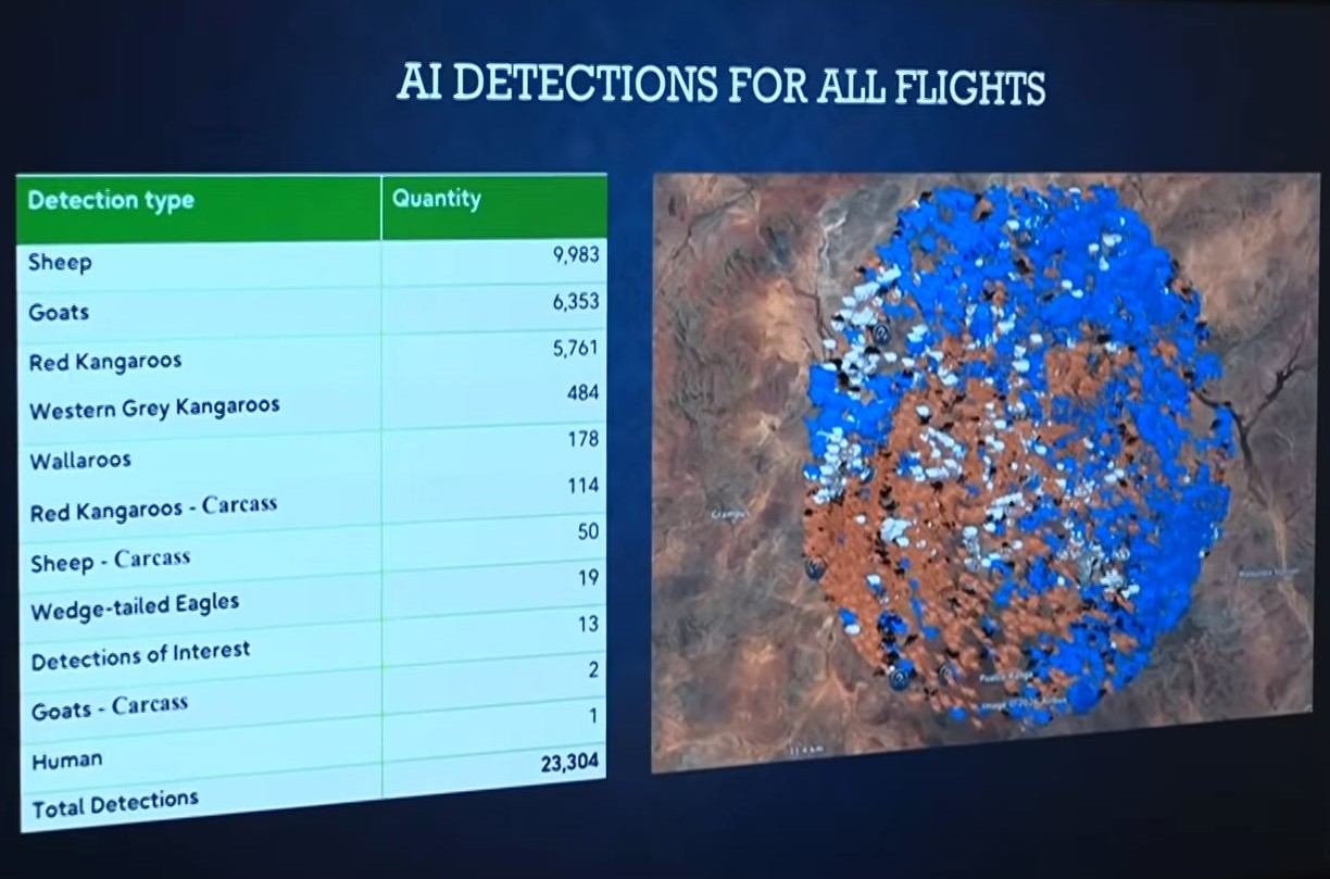
AI found one human among thousands of animals. Source: ABC News
While Fielke noted the rider was clearly "not Gus", he said the detection demonstrated how reliably the software could distinguish a person from livestock.
Crucially, investigators found no sign of Gus and no belongings linked to him.
A trillion pixels
Sci-eye founder Andrew Walsh said the search produced a dataset far beyond what humans could realistically review.
“The search area was 15 kilometres in radius, with a pixel size of one to two centimetres,” he said.
“That’s over a trillion pixels. There is no way even a large team of people could visually scan that in a reasonable time.
“But the AI can do it as quickly as the data is collected.”
The company normally uses the technology to count wildlife populations and monitor environmental conditions, but the same models can be trained to detect human activity.
Future versions may analyse footage in real time while aircraft are still airborne.
Minutes instead of days
Technology giant Fujitsu also assisted, adapting its wildlife-surveying drone platform, WildAI – produced in collaboration with Sci-eye – for investigative work.
According to the company, AI can process tens of thousands of high-resolution aerial images in minutes and produce GPS coordinates for search teams.
“In an emergency, the most critical factor is time,” said Julian Fox, industry chief technology officer for government and healthcare at Fujitsu.
“This technology can be repurposed to search for signs of human activity in vast landscapes.”
Police emphasised the technology supplements – not replaces – search crews on the ground, and human oversight remains in place whenever AI is used.
The investigation turns
After investigators failed to find anything to suggest Lamont was abducted, police identified a suspect who lived on the Lamont property.
“A person who has withdrawn their cooperation is now considered a suspect in the disappearance of Gus,” said Fielke.
“I do want to stress, however, that Gus's parents are not suspects in his disappearance.”
Police have seized a vehicle, a motorcycle, and some electronic devices from the Oak Park Station homestead, while Fielke said police no longer believe Lamont is alive.